| Click here or on any picture to switch to slideshow |
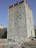 | It was the "Journée de la Patrimoine" - French National Heritage Day - a fact that I only became aware of listening to Trafic FM as I drove along the A50 from Marseille to Toulon. It raised my hopes though, because I was heading for le Revest, a small village to the north-west of Toulon which, according to the map, sported a medieval tower and a museum, the sort of places that just might have free entry for the day. After boosting the local economy by buying the now customary pain aux raisins at a bakery on the road to le Revest, I parked the car at Dardennes, the starting point of the GR 99. From there it was a half-hour's walk along quiet roads and pathways to le Revest which I reached at about 10 in the morning. It is indeed a quaint medieval "village perchée" which obviously owes its existence to the "Haute Tour Sarrasine" on the top of the hill on which the village is perched. This is a very plain square defensive tower, in remarkably good condition considering it dates to the 13th century. Apparently there are references to a Castrum de Revesto here as early as the 6th century. Sarrasine refers not to the original builders ("Saracens? Here?" I wondered) but to the type of metal portcullis which originally barred the door. Local people would have been able to take refuge in the tower whenever enemies threatened. Today to my disappointment there was a more modern gate barring the entrance, and even the nearby Coptic Museum ("Copts? Here?" I thought) was closed. |
|
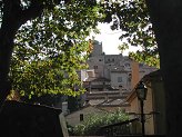 | Of course I may just have arrived too early in the day, but I couldn't hang about. My aim was to finish off a section of the GR 51 between Cap Gros and le Revest, and also perhaps take in Mont Caume, the highest of the mountains which ring the city of Toulon. It was a warm sunny day and I was hoping to take it easy, so I would need plenty of time to make the circuit. |
|
 | Le Revest is the point where the GR 51, making its way along the Côte d'Azur, intersects the GR 99, which starts near Toulon and heads inland. I now turned onto the GR 51 heading west out of the village. |
|
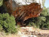 | It wasn't long before I came to this impressive overhanging rock, mentioned in the Topo-guide for the GR 51, and I took the opportunity of the welcome shade to stop and enjoy the pain aux raisins for elevenses. |
|
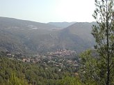 | Soon after this I arrived at Mal Vallon and the parting of the ways. It was here that I could choose to take a non-GR path (paint-marked in green) over the top of Mont Caume to come down and rejoin the GR 51 at the Col du Corps de Garde between Mont Caume and Cap Gros. This I decided to do and was soon climbing fairly steeply though mostly still in the shade of the trees thankfully. |
|
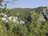 | As I climbed, the summit ridge loomed above me, topped by a typical French mountain-top installation - a huge radar station. There was therefore of course also a well-made tarmac road zigzagging labouriously up from the Col du Corps de Garde, but I was on a much more direct route. |
|
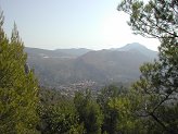 | There were excellent if rather hazy views to the south and east. Many of the other mountains around Toulon could be seen, including le Coudon and Mont Faron. |
|
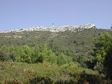 | The summit ridge of Mont Caume |
|
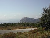 | Once the path got near the summit it joined the tarmac road, from where Cap Gros could now be clearly seen across the valley. It was less than a year before that I had reached the summit of Cap Gros on a walk from Ollioules, further west on the GR 51. |
|
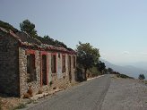 | On the way along the road there were some ruins that I guessed were something military from the nineteenth century. |
|
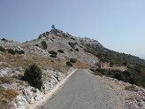 | Of course I never reached the actual summit of Mont Caume, this being occupied by the fenced-off radar station, but I had by now learned to leave behind my Munroist's obsession with "tapping the top of the cairn" when climbing mountains in France. |
|
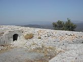 | More interesting and more accessible than the radar station were the remains of the gun emplacements on the summit ridge. These I knew about from a first encounter with them on le Gros Cerveau some way to the west. This was another link in the chain of defences built all around Toulon in the aftermath of the Franco-Prussian War, that is in the 1870s. Having found a list of the locations of the defences on the Internet, I knew that there had been emplacements at both the western end (these ones) and the eastern end of Mont Caume - the latter presumably being somewhere on the far side of the radar station. |
|
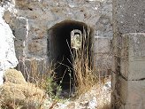 | The remains on Mont Caume were much better preserved than those on le Gros Cerveau, and you could still crawl through most of the tunnels linking the emplacements. |
|
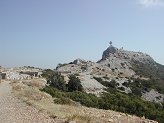 | Most of the emplacements had obviously been used in the Second World War as well, having concrete additions built within the nineteenth century remains. These are visible here, along with the many other fascinating features of Mont Caume's summit. |
|
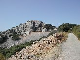 | I now headed down towards the Col du Corps de Garde, still following the green paintmarks. About halfway down I stopped in the shade of a large pine tree and had lunch. It was now about 12.30. After a bit of a rest I continued on down to the col where I rejoined the GR 51 and then started up the other side. |
|
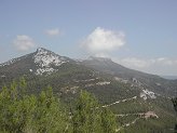 | This was a fairly short ascent, but I was now getting tired and it was pretty hot. The temperature in Toulon that afternoon was 32º C, and although I was higher up and there was a slight breeze, it wasn't a pleasant experience struggling up this second climb of the day. |
|
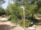 | At last I emerged on the flat plateau and reached the signpost which was as far along the GR 51 as I had come on my previous walk. On that occasion I had continued on to the summit of Cap Gros, which though close by is not on the GR, but this time I simply sat down in another shady spot and had a second lunch before heading straight back down to the col. |
|
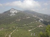 | Looking over the Col du Corps de Garde to Mont Caume |
|
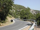 | The GR 51 made its own way down from the col, crossing and re-crossing the road numerous times. Then finally it left the road altogether and headed off towards a quarry. |
|
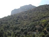 | Cap Gros from below |
|
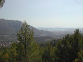 | The route that the GR used to take was along the top edge of the quarry, but either that part of the hillside no longer exists, or has become too dangerous. Instead the paintmarks now lead you a very long way round the bottom of the quarry and then, rather annoyingly, back up nearly to the top again, before finally descending to Mal Vallon, where I had branched off in the morning. |
|
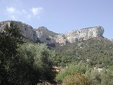 | From Mal Vallon I simply retraced the route back to le Revest then down the GR 99 to Dardennes, although I did briefly lose the way somewhere between le Revest and Dardennes. I got back to the car at around a quarter to four, making a total walk time of just over six hours. I was very hot and tired and had nearly finished the two litres of water I had brought with me. All in all it had been a good walk, but it might have been sensible to wait for the weather to cool down a little more before starting again after the summer! |
|

