| Click here or on any picture to switch to slideshow |
 | What does a hill in Provence have to do with German unification in the 19th century? More than might be expected at first glance. I went there with a friend, Daniel, on a still, hazy november day, walking along the GR 51. The hill, a rocky ridge running east-west to the northwest of Toulon, goes by the slightly bizarre name of “le Gros Cerveau” (the big brain). It overlooks the seaside resorts of Bandol and Sanary-sur-Mer to the south, with a large sandstone quarry carved out of a valley running along its north side. |
|
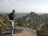 | We set off about 9am at the west end of the ridge, just off the A50, and were soon climbing a fairly steep zigzag path through dense forest. When we reached the crest we found the remains of some earthworks, which we decided looked like old gun emplacements. A little further on we came upon the remains of a fort, marked on the map as the “ouvrage de la Pointe”, ouvrage being a defensive fortification. We couldn’t decide when these structures were likely to have been built, since they looked too new to be Napoleonic, but were old enough to feature moats carved out of solid rock. |
|
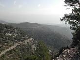
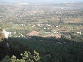 | The GR 51 winds its way along the very crest of the ridge, giving some nice views northwards towards the the massif of la Sainte-Baume, while a tarmac road runs parallel not far down the south flank. We followed the GR on our outward journey, and came back along the road. |
|
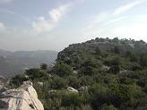
 | Looking back westwards along the ridge crest |
|
 | About halfway along the ridge, at one of the points where the path and the road converge briefly, I suddenly spotted something on the map - just below where we were, on the north side, there was apparently a cave - the “Grotte de Garou”. Going to the very edge of the escarpment and peering down westwards we could just see it - but was it accessible from here, we wondered? |
|
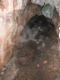 | We soon found some tell-tale paintmarks indicating a recognized path down off the ridge, which we scrambled down. The path led over a rocky outcrop and round to the cave, which proved to be quite impressive. The entrance was not deep, but beyond this there was a high shelf, accessible by a sort of narrow rock stairway, and this opened back into a very deep cave. Alas we had no torch so we could only go so far, then take pictures with a flash to see what was beyond. According to my guidebook, traces of “prehistoric industry” have been found in the cave, though all we could see were stalactites. |
|
 | Looking out of the cave |
|
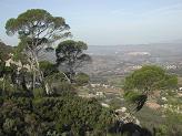 | Looking north west with la Cadière d’Azur in the distance |
|
 | Another view westwards |
|
 | Back on the ridge we continued on to the highest point, where we found another “ouvrage”. It turns out that these fortifications were built between 1874 and 1881 as part of a ring of outer defences protecting the naval port of Toulon. But why were the French suddenly so concerned to defend Toulon in 1874? After a little historical research back home I found the answer. At that time France had just suffered a humiliating defeat in the Franco-Prussian war of 1870-71, losing Alsace-Lorraine to Prussia’s ambitions for German unification. Italy, also freshly unified under Garibaldi, were a further threat to France’s south-eastern border. Determined not to be defeated so easily again, the French embarked on a vast programme of defensive construction under General Séré de Rivières. The idea was to surround a number of key cities in eastern France by a ring of outer defences. Most of these key cities were in the north, but some, notably Toulon and Nice, were in the south. You can read all about this building programme at http://lpracht.free.fr/sdr/fortif.htm. |
|
 | It was fascinating to spread out the IGN 1:25000 map of Toulon and identify the semi-circle of defences built to protect the port on its landward side. This also explained the rather puzzling feature we had noticed, that many of the gun emplacements were not facing the sea as you might expect - in fact they were all facing away from Toulon. |
|
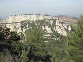 | From the highest point we continued on a short way to a viewpoint that was marked on the map, from where you could see the “Grès de Sainte Anne” - some strangely eroded cliffs on a ridge to the northwest. |
|
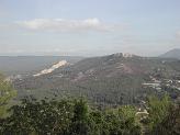 | From here looking east you could also see the Fort du Pipaudon, another of the defences around Toulon, as well as the historic village of Evenos. The GR 51 continues in this direction, winding its way along the hills above Toulon. |
|
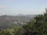 | In the distance Mont Caume (801m) rose prominently to the east. The map showed that there were more defences built on top of that hill as well. |
|
 | Returning along the road below the ridge crest |
|
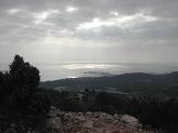 | As we tramped back along the road the sky was clouding over, but the rain stayed off and we got back to the car at around 3. A pleasant walk, some impressive views, and a little bit of French history thrown in. |
|
 | The ridge seen from our starting point |
|

