 | For a change, this was a climb on my own - one of only two lone days in the summer of 2004. Indeed, apart from the farmer in his tractor gathering in hay bales at Auchessan Farm in the morning, I saw no-one else all day. My first problem was where to park. The SMC guidebook mentions the nearest available place being "a few hundred metres west along the main road" from the Auchessan turn-off, but I couldnít see anything that answered this description. Cameron McNeish only suggests doing these hills from Glen Lochay, so no help there. It was true that there were 'No Parking' signs in profusion along the Auchessan farm road, but not right at the start, where I squeezed discreetly against the fence and set off.
I continued past the farm along the track which went through two gates then seemed to be doubling back away from the hills. So I struck off across the pathless boggy moors, wincing at how far I had to go over this terrain before even reaching the mountain proper. I followed a bearing of 340 degrees, since the hills were somewhat ominously all in cloud. The moor seemed to rise gradually before me forever. The monotony was broken by a crossing of the Allt Glas, and sighting a herd of deer. Then, when I came to the Allt Coire nam Moine, I abandoned the bearing and followed the stream up steeply to the flat (and of course boggy) shelf below Meall Glas.
From there I continued on another bearing, heading up the steepish upper slopes of Meall Glas into the mist, finally arriving at the summit two and a half hours after leaving Auchessan. The fact that the tops of all the hills were in cloud all day was another morale-lowering factor, on top of the total alone-ness, the lack of any path, and the general roughness and bogginess of the terrain.
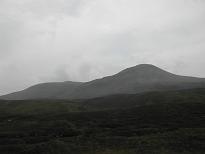
I ate some lunch at the summit of Meall Glas, then quickly found my way by map and compass to the trig point on its subsidiary Top, Beinn Cheathaich. Forgetting the guidebook's advice to avoid the very steep direct descent east from there, I descended directly east, very steeply! Down at the col I was out of the cloud, and in fact so was Beinn Cheathaich, briefly, allowing me to take at least one meaningful photo of the day. |

