| Click here or on any picture to switch to slideshow |
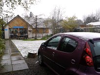 | The forecast for today was light rain and low cloud pretty much everywhere all day. It was a great surprise therefore for the hostellers in Newtonmore to wake up in the morning to find it was snowing, and had been for some time by the look of it. My decision not to try and tackle Cairn Gorm seemed to be confirmed, but I wondered how I would get on even with the Loch Lochy hills. I was relieved to find that, although Newtonmore was shrouded in snow, only a few miles down the A86 there wasn't a trace of it anywhere except on the higher hills. It was however drizzling steadily, as promised. |
|
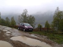 | Driving down the A86 I was reminded of other less than ideal days I had spent in the hills - the day I climbed Creag Meagaidh in a snowstorm, and the soaking I had had on the hills by Roughburn, for example. By the time I reached the shores of Loch Lochy I was already thinking of the walk ahead of me as "Roughburn Revisited". I was mentally resigned to a "head down and get on with it" sort of a day. In an effort to shave as much as possible off the walk I drove up the potholed track at Kilfinnan until a sign announced that the road beyond was private, then parked on the grass verge and got booted up in the car. |
|
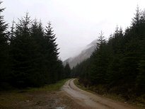 | Once out of the the car I soon discovered that the drizzle, if persistent, was nevertheless light. What's more the cloud was not all that low and I got occasional glimpses of the hills I was going to climb as I trudged along the flat forestry track. There were also occasional glimpses of Loch Lochy looking pretty mournful through breaks in the trees on my left. |
|
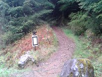 | As I walked along I wasn't really getting particularly wet at all, and I decided that so far "Roughburn Revisited" was not such an appropriate title for the day after all. I found the start of the Cam Bhealach path without difficulty, marked as it was by a sign concerning a diversion for those who were hoping to continue down the other side by Gleann Cia-aig. That path was closed and the diversion went by a pathless route through Gleann Tarsuinn, which I was glad I wasn't going to have to tackle that day. The sign was also surmounted by an upturned hiking boot which looked to be in reasonable condition. Whose was it and why was it there? We shall never know... |
|
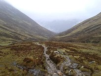
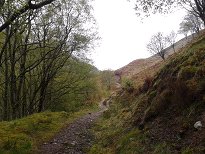 | The path climbs fairly steeply and soon gets clear of the trees, allowing you to see something of the hills around - on days when they aren't in low cloud, that is. Today I could see the lower slopes at least, and had hopes that I might reach the bealach before I got into the mist. |
|
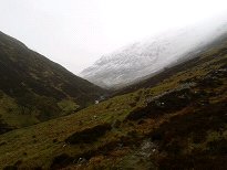 | I was a little puzzled as to why the entire valley was labelled "Cam Bhealach" on the map - surely the bealach is only the highest point? Well no, not necessarily. The Gaelic "bealach" (or Welsh equivalent "bwlch") can apparently refer to an entire mountain pass from start to finish, so I was indeed walking up the Cam Bhealach, which incidentally means "bent pass" although it didn't seemed to be any more "bent" or winding than any other highland pass I'd been in. |
|
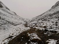 | The path is easy-angled and climbs steadily making for a fairly pleasant walk. The drizzle continued, but never got any heavier so I wasn't too troubled about that either. What I was wondering about was how much snow there would be at the summits and whether I would have any navigational problems getting to them as a result. Well before I reached the bealach (that is, the highest point of it...) I was into a light covering of snow, although the path was still clear and obvious. |
|
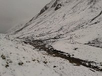 | At the top a lone fencepost marked the highest point. Did such a lone sentinel merit inclusion in my collection of "Fencepost Phenomena of the Scottish Highlands"? It is after all something of a mystery why it is there all on its own. Presumably it was simply left as a marker when the others were taken away. From here I could see what looked like the path to Meall na Teanga, although it wasn't very clear and I fully expected it to disappear fairly quickly higher up. However it isn't far to the summit and I still wasn't into the mist proper so I wasn't too worried. |
|
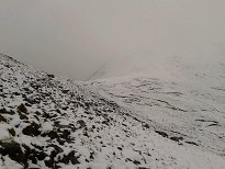 | I managed to stay on the path all the way round the flank of Meall Dubh although whether there was any advantage to this I don't know since it was extremely boggy in places. In any case, it assured me that I was on the right track for Meall na Teanga, and soon I could see the second bealach, between Meall Dubh and Meall na Teanga. |
|
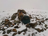 | In the end I managed to stay on the path right to the top of the summit ridge of Meall na Teanga. Halfway up I saw what looked like two walkers perched at the top of the steep slope a little way off the path to the left. They didn't seemed to be moving, nor were they together but had some distance between them. I wondered why they weren't on the path. Once on the ridge the path all but disappears, but it is an easy walk along the ridge and I had no difficulty finding the summit cairn. |
|
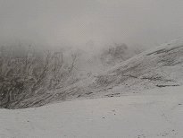 | On the way back down I was slightly troubled to see the two walkers still perched exactly where the had been before. I started up towards them but soon decided that they weren't people at all but just a couple of oddly shaped rocks. Which explains why they were neither moving nor seeking each other's company! As I got near the bealach I did however meet two genuine flesh and blood fellow-walkers, the only other people I saw on the hill all day. They asked how long it took to get to the summit - about 45 minutes I reckoned, and we parted fully expecting to meet again somewhere on "the other one" - that is, Sron a Choire Ghairbh. |
|
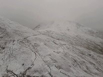 | The path up Sron a Choire Ghairbh is one of those excellent zigzagging stalker's paths which gave me no trouble at all until I reached the snowline. There the path disappeared and I was into the mist again. I continued up on a bearing until the slope flattened out and I knew I was on the crest of the ridge. I then turned left and continued on another bearing, now trudging through up to a foot of snow. It wasn't too long before the summit cairn loomed up out of the mist. Unlike the previous day, the snow was soft and I had no problem finding my way down again simply by following my own trail of bootprints. |
|
 | I was back down at the bealach before I met the two other walkers again. I told them that there was a lot more snow on the second summit, but that they only had to follow my trail to get to the summit. There wasn't anywhere dry to sit down so after a standing lunch of a couple of sandwiches I was soon heading back down the path. |
|
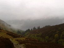 | The weather conditions had not really changed much at all during the walk. "Atmospheric" was about the most positive adjective that could be used to describe the view of Loch Lochy as I came back down the Cam Bhealach path. Well, at least I could actually see it. The walk back along the forest track seemed fairly quick too and I was back at the car six and a half hours after I had set out. This compared well with the Cicerone guide's estimate of 6 hours 25 minutes without counting stops. |
|
 | I now headed off up the A82 to Inverness. I stocked up with bread at Invergarry and stopped at Fort Augustus to buy the Scotsman where a coachload of French tourists had just arrived to see the canal locks. The drizzle gradually eased off as I drove north and by the time I reached Inverness I was looking forward to having a stroll around the town while waiting for Ruth. However I got out of the car to be greeted by a freezing wind, so once I had bought myself a haggis supper I retreated to the car to eat it. Ruth arrived on the bus, having already eaten, so after buying a bag of coal we set off up the road to Achnasheen. We were planning to spend three nights at the Jacobites' Club Hut there - the coal was a precaution in case there was no fuel at the Hut. In any case, the thought of a roaring fire seemed very inviting! |
|

