| Click here or on any picture to switch to slideshow |
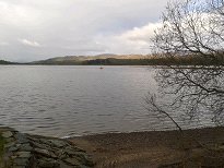 | I had arrived in Edinburgh the previous day and had an uneventful drive up to Newtonmore. Uneventful, that is, apart from a catastrophic incident at the Drum Brae lights on the Queensferry Road, where I opened the 2 litre bottle of Irn Bru I had just bought at Asda only to have a good part of the contents spray all over my nice clean hire car, the Wee Purple Peugeot. This meant a stop at the north end of the Forth Bridge in to try and clean things up a bit. I was booked in to the small and super-friendly Newtonmore Hostel, which was otherwise filled with walkers on the 2012 TGO (coast-to-coast) Challenge. I was up early in the morning in order to tackle the Glen Feshie hills, Sgor Gaoith and Mullach Clach a Bhlair. It would be a long day, especially for Day 1 of the trip, and perhaps made longer by the amount of snow that was obviously on the summits. I drove up the road to Kincraig, then turned off past the Watersports Centre at Loch Insh, through Feshiebridge and so into Glen Feshie. |
|
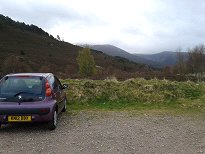 | Perhaps the good folk of Auchlean Farm have in the past had some bad experiences with the aroma of smelly boots as walkers return to their cars after a day in the hills. Whatever the reason, the car park seems to be located a very long way down the road from the farm, which is otherwise the starting point of the walk up Sgor Gaoith, the first of my day's objectives. |
|
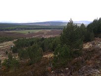 | Once past Auchlean I climbed the excellent path through a small patch of forest before emerging below Coire Arcain, on the north side of the Allt Fhearnagan. I was not long out of the trees and had stopped to remove a layer when I was passed by three people, somewhat spaced out, at least two of whom were in wellies. Clearly not Munro-baggers then, more likely estate workers. But what was their business at this time of year, well outside the stalking season? |
|
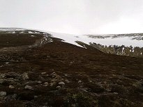 | It turned out that one of them probably was a Munro-bagger, and probably had been wearing appropriate Munro-bagging footwear. The other two I found a bit further up, busy improving the path. It was clearly thanks to their efforts that the path was so good, the quality deteriorating noticeably once I had got past them. In fact, it wasn't long before the quality of the path became fairly irrelevant since the whole thing was completely covered by snow. Since it looked like I would soon be in mist which was still clinging to the higher ground, it was time to get the map and compass out and start heading up on a bearing. |
|
 | My plan was to find the summit of Carn Ban Mor, and then make for Sgor Gaoith on a bearing from there. The combination of mist and snow on a featureless swelling such as Carn Ban Mor makes it extremely tricky to find the summit, but after some time I came upon a small cairn which I assumed was it. From there I followed a bearing which I reckoned would take me to the summit of Sgor Gaoith in half an hour. The ridge begins very wide and flat, but narrows so much at the summit that I knew I couldn't really go wrong. The only danger was the steep drop into Glen Einich somewhere to my right, with the possibility of treacherous cornices at some points. However, thankfully the mist was light enough for me to spot such features in plenty of time to give them a wide berth. And sure enough, after about half an hour of patient trudging through the snow, a distinctive-looking peak loomed up ahead. |
|
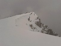 | I now had to get within a certain distance of the edge of the precipice just to reach the summit, but I still gave it as wide a berth as I could and got to the summit cairn without mishap. The MWIS forecast had promised that low cloud should clear the summits by early afternoon, however it was still only about 11 o'clock so I was hopeful that the conditions would improve later on. |
|
 | It may look like I was straying perilously close to the snow cornice in order to take this photo of what little could be seen of Loch Einich down below, but I'm sure I was safely on solid ground. On a clear day you can see across to the western corries of Braeriach from here, and as the mist cleared I did catch the occasional glimpse now and again. |
|
 | The mist still stayed with me as I retraced my steps back to the summit cairn of Carn Ban Mor. The snow wasn't even soft enough for me to have left visible bootprints, so I was once again relying on the compass to get me there. However soon after this, as I continued on southwards, I started to drop lower and the cloud began to lift a little higher so that before long the whole plateau came into view. I could now see my next objective, Mullach Clach a Bhlair, the only disadvantage about this being that it looked like a very long walk from where I was! |
|
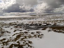 | I now had the choice of heading straight towards Mullach Clach a Bhlair across the undulating plateau or veering left to join up with the landrover track which I could now see in the distance and which I knew would lead me almost to the summit. I was finding that some of the ground was pretty boggy, so the track won the day. Even so, I had to do quite a bit of frozen bog-hopping just to reach it. |
|
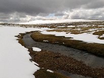 | The first thing the track did after I finally joined it was to ford a small burn. Fortunately this one was easily jumpable. Further on I came across another burn which was entirely covered with snow. The only reason I knew there was a burn there was because I could see it down a hole where the snow had fallen through. I had to creep forward over the snow expecting at any moment to plunge through and land in the icy stream. To my relief however the snow held up. |
|
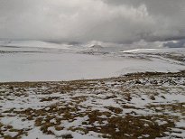 | All the while I was enjoying some great views of the rest of the Cairngorms to the east. I had climbed pretty much everything I could see during my last visit to the Cairngorms, 12 years before - I managed to pick out Monadh Mor, Cairn Toul, the Angel's Peak and Braeriach. They didn't seem too far away, and indeed guidebooks often mention this western approach as one possible route to get to these summits. |
|
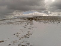 | The track was reasonably easy to follow, even if it was often more or less covered with snow, and I did lose it completely for a short distance beneath a larger snow patch. It didn't seem too long before I reached the point where an obvious path leaves the track to take you straight to Mullach Clach a Bhlair's flattish summit. The path was obvious even in the snow. |
|
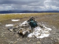 | I reached the summit at about quarter past one - I seemed to be making pretty good time, and my legs were still bearing up. As can be seen from this photo, there were even some occasional sunny spells to cheer my spirits too. I didn't put on any sun cream even though I had it with me since there seemed so little sunshine, but the next day I discovered that I had in fact got somewhat burned by being out so long with a combination of light cloud above and snow on the ground. |
|
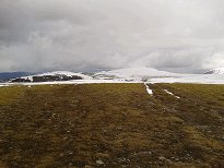 | I didn't hang about too long at the summit as I knew there was still a long way to walk back to Auchlean. Here you can see the striking difference between the amount of snow not far from the summit of Mullach Clach a Bhlair (i.e. none) and how much was still on Sgor Gaoith, which admittedly is about 100m higher. |
|
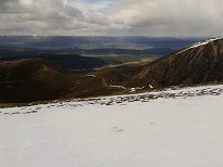 | I hadn't spotted the track that would take me back down into Glen Feshie on my way over, and it turned out that this was because it branched off under the large snow patch where I had lost the track completely. I headed down from there but it still took me a while to find the track once I was off the snow. |
|
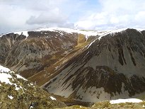 | As well as the two Munro summits on this plateau, there are also five subsidiary Tops. Carn Ban Mor is one of them, the only one I went over, and there are three others to the north of Sgor Gaoith. The other one is Meall Dubhag, which is actually closer to Mullach Clach a Bhlair although I suspect it is a subsidiary Top of Sgor Gaoith like the other four. It would have been fairly easy for me to have taken it in on my way across, if I hadn't been trying to reach the landrover track as quickly as possible. From the descent on the track there are some impressive views over the steep-sided Coire Garbhlach. I had wondered about using this corrie as a shortcut back to Auchlean but by the time I started looking for ways down into it they all looked too steep to actually make the route any shorter timewise. It is probably possible to get into the corrie from the very top, and I could see some signs of a path winding down at the bottom of it. |
|
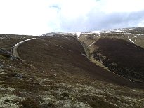 | Having decided against a direct descent into Coire Garbhlach, the next route to tempt me was an obvious path leading up from the track to the minor 800m bump that now rose to the right. However a glance at the map showed that the descent on the other side, if it existed, would be almost as steep, and considerably longer, than the routes into the corrie that I had already rejected. It looked like I was going the long way round, following the track all the way down to the glen. |
|
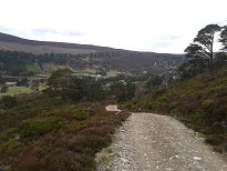 | As it turned out, this route was easy going on tired legs, and also became very pleasant once it got down into Glen Feshie with its scattering of ancient Scots pine trees. Glen Feshie was a favourite haunt of the nineteenth century painter Sir Edwin Landseer. His iconic "Monarch of the Glen" was very probably inspired by a stag that he saw in Glen Feshie. Of course, he probably shot and killed it after his moment of inspiration. He was a friend of Sir Walter Scott and his paintings, like Scott's novels, helped to fuel the romanticized image of the Scottish highlands that took Victorian Britain by storm, leading in turn to the mania for deer-stalking that has left its mark on the highlands right up until the present day. And it all began here (for Landseer anyway) in innocent-looking Glen Feshie. |
|
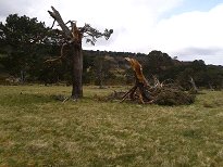 | It was only a few months previously that we had heard news reports, even in distant Marseille, of furious gales that were ripping across Scotland. Gusts of up to 165mph were recorded on the summit of Cairn Gorm, not far from here. The pines of Glen Feshie, like trees in many other parts of the country, fell victim to these storms, and I saw signs of this all along the glen. This was one of the more spectacular examples, where the tree had actually survived the storm but at the cost of losing about half of its branches. |
|
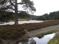 | I hadn't been intending to cross the river by the bridge at Carnachuim, which was just as well since it no longer exists, having been swept away by the river in spate some years previously I think. The walk along the glen on the east side of the river is in any case very easy and pleasant to begin with where there is a good track. |
|
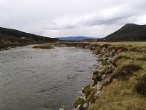 | After some way the track enters a denser patch of forest and here the map and the reality seemed mysteriously to part company. I came to a T junction with a choice of heading left on a path towards the river or right on a track away from it. I could see nothing like this on the map and in the end I decided to head for the river. I was rewarded after a short while by seeing unmistakable signs of boots and bike tyres having passed this way before me, so I decided I was still on the right way for Auchlean. Once the path reached the river it turned north and stayed close to the east bank pretty much all the way to Auchlean Farm. Somewhere along this stretch I met a TGO Challenger who asked me if there was "still a bothy in Glen Feshie?". Unfortunately I had no idea, but I learned later that in fact there is. I only hope the poor soul found it in the end! |
|
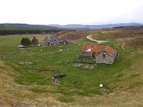 | Perhaps predictably, Auchlean Farm itself is well fenced off with barbed wire fencing and signs directing walkers up and over some hillocks to the right in order to keep them well away from the buildings. Surely at this stage the aroma of hiking boots is still safely contained? Ah well, maybe the good folk of Auchlean just really don't like walkers. And so I managed to drag my smelly but safely contained weary feet up a few more metres of ascent, then back down onto the road and so along to the still painfully distant car park. |
|
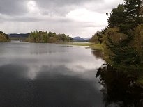 | The walk had taken me 8 hours 10 minutes in total, but the important thing was that my legs had proved to be up to it, despite not having been required to do anything like this for about a year. I drove straight back to the hostel in Newtonmore to find a different set of TGO Challengers in, and, like the previous evening, free home baking available on the common room table. The weather forecast for the following day was not good. I had been thinking of Cairn Gorm, but I now started changing plans and thinking about visiting the Loch Lochy hills on my way to Inverness, where I was due to meet Ruth off the bus at 10 past 8 in the evening. |
|

