| Click here or on any picture to switch to slideshow |
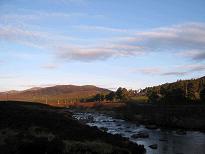 | I woke up at 4.30am feeling rather cold so I got some more clothes on and dozed for an hour. At 5.30 I crawled out of the tent to be greeted by a cloudless blue sky and sun on the mountains. Today promised to be a long day so I was very much hoping this weather would stick around for a while. I had breakfast and made up some sandwiches and it was still only about 6.30. |
|
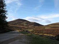 | I'd heard rumours that the car park charge at Spittal of Glen Muick was extortionate, so I decided to try cycling the remaining 5km up the glen. However I had problems adjusting the seat on Ruth's bike, and couldn't really ride it at the height it was at, so eventually I gave up and took the car. This at least meant that I was at the start of the walk by about 7 o'clock. |
|
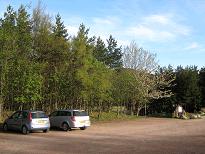 | The charge for parking was actually only £3 for the day which didn't seem too bad even to a skinflint such as myself. The toilets were however closed due to "lack of water", incredible as that may sound, so the parking charge wasn't quite so worthwhile today. |
|
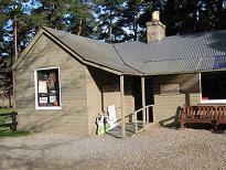 | I had a quick peek in the visitor centre, which was open even at this unearthly hour. I don't really remember what was in there though, so presumably nothing very exciting. |
|
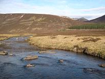 | Then I was off across the flats by the River Muick, where I saw a herd of deer in the distance - you can just make them out in this photo. |
|
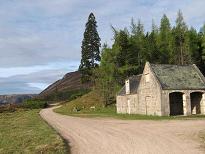 | At the far side of the flats the track passes close to Allt-na-giubhsaich Lodge. I think this is actually the gig house and stables. Allt-na-giubhsaich was a favourite haunt of Queen Victoria and Prince Albert. Queen Victoria apparently referred to it as "the little bothie". In fact, this was not the last time I was to follow in Queen Victoria's footsteps that day. |
|
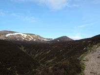 | There followed a pleasant forest walk for a short way before the track emerged from the trees, climbing towards Clais Rathadan. I heard and saw lots of capercaillie around here, as well as the occasional hare. |
|
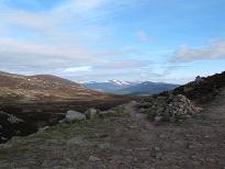 | An obvious cairn marks the equally obvious path which branches away from the track and heads across the moor, dipping slightly before taking you up the eastern slopes of Lochnagar. |
|
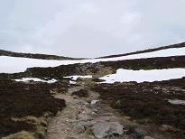 | I was now getting quite high and there was plenty of snow around, but the path was exceptionally clear, where it wasn't covered in snow that is. This is of course the route taken by Queen Victoria when she climbed Lochnagar. I'm not sure how often she did it, but it is possible she reached the summit of Cac Carn Beag in mist on her first ascent in 1848. This would have made it her first Munro, although of course it was well before the days of Sir Hugh and his list. Meanwhile today the beautiful blue sky seemed to be clouding over before I had even got to the top of the ridge to enjoy the spectacular view of the cliffs I had heard so much about - I was not amused... |
|
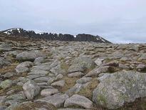 | The cliffs come into view |
|
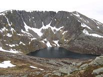 | Guidebooks tend to recommend the ascent of Meikle Pap, a subsidiary Top of the first Munro, Cac Carn Beag, if only for the even more impressive view of the cirque and the loch from its summit. It only took me 15 minutes to make this detour and return to the col, and it was indeed well worth it. |
|
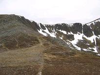 | The next part of the route is known as "The Ladder" - the short steep section which takes you up onto the plateau. Again the path is exceptionally good, having been engineered especially for the comfort of Her Royal Highness in the 19th century. |
|
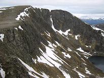 | The cliffs again |
|
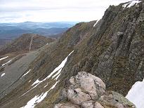 | I had seen another walker on Meikle Pap as I was climbing The Ladder - the first person I had seen on the hill that day. It was after all only about 9.30 by this time. |
|
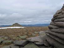 | There are a couple of odd things about Cac Carn Beag, the summit proper of Lochnagar. The first thing is that it is higher than Cac Carn Mor by 5m, so the names appear to be the wrong way round. The second is the actual meaning of the name which, according to Wikipedia, is "small cairn of faeces". Steve Kew on the other hand translates it as "slope of the wee cairn". The question seems to hinge on what the Gaelic term "cac" means. Is there in fact some devious connection with the French term <i>caca</i> (a child's word for faeces)? Well, since <i>caca</i> actually comes from the Latin <i>cacare</i> (to defecate), it seems entirely possible. Perhaps we shall never know. I can't help wondering whether Queen Victoria ever asked her ghillie about the meaning of the name, and what her loyal and obedient servant found to say in reply. "Well, Your Majesty, it <i>could</i> be translated 'slope of the wee cairn'..." |
|
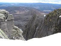 | Looking over the cliff edge |
|
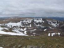 | Summit video on Cac Carn Beag |
|
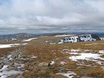 | At the summit of Cac Carn Beag I had a phone signal so texted Carrie and phoned Mum. After a brief rest and a summit video I headed off once more, meeting the guy I had seen on Meikle Pap as I came down. He was German, and appeared to be planning a similar route to mine. I took his picture and he headed on to the summit while I set my sights on the next Munro, Carn a' Choire Bhaidheach, which is no more than a vague swelling on the plateau. |
|
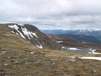 | Loch nan Eun below the Stuic |
|
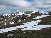 | Looking back to Cac Carn Beag |
|
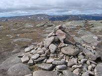 | The summit of Carn a' Choire Bhaidheach is so nondescript that the path doesn't even go over it, so Munroists wanting to tick it off have to make their own way to the cairn. I also included some detours to take in some snow patches. |
|
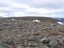 | The next Munro of the round is Carn an t-Sagairt Mor, but I decided to take in its little sister Carn an t-Sagairt Beag as well, it being a subsidiary Top which is just 3m lower in height. The day had now become a pleasant tramp over the vast distances that separated the Munros. The sun had pretty much disappeared but the cloud was high and visibility was excellent. |
|
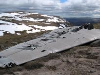 | I met the German again several times. As we were climbing Carn an t-Sagairt Mor we found the wing of a crashed aeroplane and stopped to look at it together. It turns out it belonged to an RAF English Electric Canberra which crashed on 22nd November 1956, more than 50 years before. You can make out its number on the wing - WJ615. It was on a night sortie from RAF Upwood in Cambridgeshire and crashed here for an unknown reason, both of the crew being killed. You can read more details <a href="http://www.aircrashsites-scotland.co.uk/canberra_c-t-sagairt-mor01.htm" class="news" target="_new">here</a>. |
|
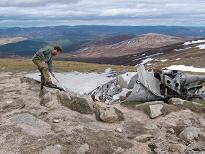 | The German walker makes his mark |
|
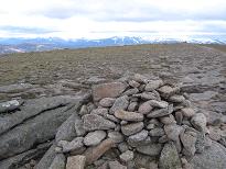 | The summit of Carn an t-Sagairt Mor |
|
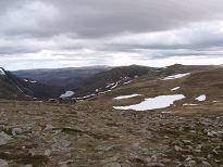 | Carn an t-Sagairt Mor was my Munro number 183, or the significant "100 to go" mark. It is not of course a particularly inspiring summit for such an occasion, but I shared the news with my German companion nevertheless. Together we discussed what the various lumps ahead of us were, getting it wrong. What we identified as Fafernie (another Top) was in fact Cairn Bannoch, the next Munro. |
|
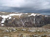 | Eagles Rock from Cairn Bannoch |
|
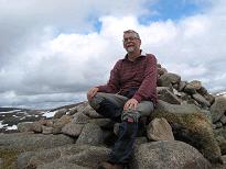 | As I headed across I realized our mistake, and arrived at Cairn Bannoch shortly after the German. He still thought it was Fafernie, so I persuaded him otherwise. I stopped here for lunch as there was now some sunshine to be enjoyed. I didn't see the German again except in the distance on Broad Cairn. I did meet several other walkers from this point on however - in fact it was getting quite crowded compared with the early morning hours! |
|
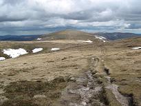 | Approaching Broad Cairn |
|
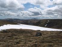 | Looking south to Driesh and Mayar |
|
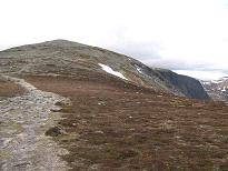 | Then I was at the summit of Broad Cairn and had all five Munros under my belt. I hadn't had a phone signal since Cac Carn Beag and still didn't have one here, however I got one quite soon on the descent from Broad Cairn and phoned Mum and Ruth to let them know I was safely round and heading back to camp. |
|
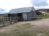 | Next stop was the tin shed just above Corrie Chash, known as Allan's Hut I believe, although there was no sign of Allan today, whoever or whatever he is. From here the route back to Spittal of Glen Muick is straightforward, but very long. |
|
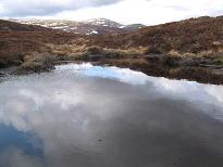 | A lochan by the track |
|
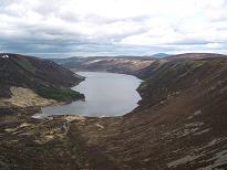 | You do in fact have a choice of routes from here. There is a good path that angles down the hillside to reach Loch Muick near its head, or you can stay on the vehicle track at the top of the hillside until it descends steeply to cross the Black Burn where the two routes join up again. I chose the path down the hillside. |
|
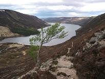 | Descent to Loch Muick |
|
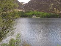 | The building that can be see on the far shore of Loch Muick is Glas-allt-shiel Lodge, which was built by Queen Victoria in 1860. Apparently when Prince Albert died the following year, this became one of her favourite retreats, since it did not have so many painful memories of her late husband attached to it. Today it is still a favourite hunting lodge of Prince Charles. |
|
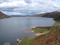 | Loch Muick |
|
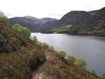 | The late afternoon was turning out quite nice again, and my legs were more or less bearing up for the long trudge along the lochside. It was getting decidedly touristy down here by the loch, so I didn't stop much, just pausing to take the occasional photo. |
|
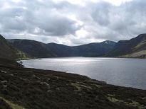 | Sunlight on the loch |
|
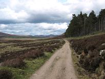 | Near the northeast end of Loch Muick |
|
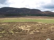 | Deer herd, Allt-na-giubhsaich beyond |
|
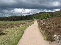 | Gradually the end of the loch drew closer, and then the trees by Spittal of Glen Muick. I finally arrived back at the car at 4.20, giving a round trip time of 9 hours 15 minutes. This I thought compared very well with the Cicerone Guide's estimate of 9 hours not including stops. |
|
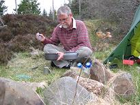 | It was now quite sunny so it was nice to head back down Glen Muick to the campsite to relax. There were a few midges around so I lit a moon tiger to keep them away. What I didn't realize at the time was that the place was crawling with deer ticks, and I spent the next few days picking them off myself. Here I am tucking in to my gourmet dinner of baked beans and sausages. Who took the picture? OK, I confess, it's just a pose taken with the timer... |
|


