| Click here or on any picture to switch to slideshow |
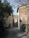 | In April 2004 I had walked north-east from Signes along the GR 99, getting as far as the north-east end of la Petite Colle, the escarpment south-west of Mazaugues. I now planned to continue exploring the GR 99, starting at Mazaugues and first climbing the escarpment from the north-east, then going back through Mazaugues to follow the GR northwards in the direction of Tourves. Mazaugues is a small village nestling among the hills south-east of Brignoles surrounded by fields, woods and vineyards. |
|
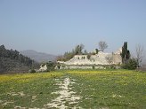 | On a prominent hill above the village of Mazaugues there are the ruins of a medieval castle, which was my first port of call on the way up to the escarpment. Not much remains of the castle, and even less can be found apparently by way of contemporary references to it during the Middle Ages. It must be assumed that this was the site of the original fortified village, the residential quarter spreading down the hill towards the plains in more peaceful times. |
|
 | Inside the castle ruins |
|
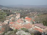 | After a short detour part way down the steep hillside above the village I had an impressive view over the rooftops, showing the typical huddle of ancient buildings that make up these villages perchés which are found dotted around Provence. |
|
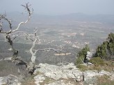 | From the castle ruins I followed the GR up by a fairly steep route onto the ridge. Once on the crest the slope flattened out to reach the point which I had reached from the opposite direction three years earlier. |
|
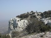 | Although the hilltop looked familiar I was not terribly sure whether I had really come this far, so I pressed on a short way to make sure. Having convinced myself that I really was on familiar ground I turned to head back towards Mazaugues. |
|
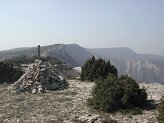 | This is the picture I took on the hilltop which corresponds almost exactly with one I had taken on the previous trip. Conveniently it was now lunch-time so I took the opportunity to have a lunch with a view. |
|
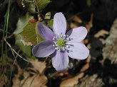 | There were plenty of spring flowers appearing here and there in the woods on the hillside. I spent a bit of time on the way back down to Mazaugues trying to get some nice close-up shots of some of them. If I were a botanist I would even be able to identify what they were! |
|
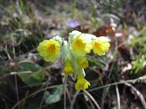 | Yellow flowers |
|
 | I was back in Mazaugues by 1 o'clock, but the route I had planned to the north was fairly long, so I didn't hang about. |
|
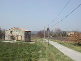 | I was soon heading out of the village by quiet roads through fields and vineyards before turning off onto a dirt track. |
|
 | The map shows an area just near here marked "Aéromodelisme" so I was keeping a look out for low-flying model planes, however I didn't spot any. It was an area criss-crossed by numerous tracks and paths so it was tricky at times to stay on the GR. |
|
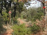 | The path gradually sloped downhill over the Plateau de Cassède for several kilometres, and then finally at a point about 4km from Tourves I reached a junction where the GR 99 crosses a local ET (Excursionnistes Toulonnais) walk. This was where I was leaving the GR to descend westwards to the Caramy River beside which another path led back southwards towards Mazaugues. |
|
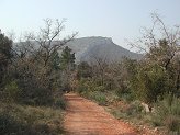 | This was the track heading down towards the river. Ahead is a steep hill on which sits the Chapel of St-Probace. What I was particularly wanting to see was an old Roman bridge which was shown on the map at the point where this track crossed the river. |
|
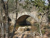 | Whether the track actually also follows the route of a Roman road is not clear, but the bridge was almost certainly on the route between Tourves (the Roman outpost of Ad Turrem) and Toulon. There are apparently a few Roman remains in Tourves, but I was not going that far today. |
|
 | The bridge is in remarkably good condition for a structure that has presumably been there for at least sixteen hundred years. It is still in use and has no signs of any major structural problems. Clearly those Roman chappies knew what they were about. |
|
 | Once over the bridge it was time for me to turn southwards on a rather tortuous route which followed the Caramy River back towards Mazaugues. I soon found that this is a favourite picnic spot for families who could be seen at intervals sitting by or splashing around in the water. |
|
 | As I got further up the valley the picnickers became fewer and eventually I had the path to myself again. |
|
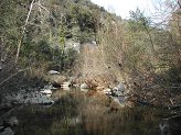 | The valley narrowed and the path also became increasingly narrow and overgrown. At times I thought it was going to peter out completely, although it is clearly marked on the map. However it stayed with me and took me to the point where a track winds up the side of the valley to the top. I was now back quite near the "Aéromodelisme" but I soon discovered that a different leisure activity had now found it's home here - quad-biking. I found myself picking a route through a network of dirt tracks which enthusiasts were enthusiastically and noisily haring around. |
|
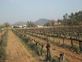 | It was a relief to get back to the peace and quiet of the fields and vineyards around Mazaugues. I got back to the car at about half past four and headed back to Marseille - about an hour's drive. |
|

