| Click here or on any picture to switch to slideshow |
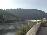 | The estimated time for this walk in the topo-guide was 7 hours 10 minutes, but it looked even longer on the map - it seemed to stretch halfway across the Bouches-du-Rhône! Anyway, it was school holidays, so I took the opportunity to do a long day. I left by car about 7.30, up the A51 to Aix. There were no parking spaces in my usual haunt on the Traverse du Cirque, so I just went into the Parking Méjanes. It was only about 8.10 when I got to the bus station. I checked the bus time for Mirabeau - 8.45 - bought my ticket and waited. The bus was very busy, unlike most of the rural buses I’d been using. This however was the bus to Briançon and Gap. It doesn’t go into Mirabeau but, as the topo-guide says, stops at the Hostellerie de Malacoste, only a few minutes walk from the Pont de Mirabeau. |
|
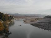 | The Durance from the Pont de Mirabeau |
|
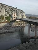 | So I was soon on the GR 9 and off south over the bridge. On the far side I lost the GR almost immediately due to an unmarked turn-off into what appeared to be a ditch. Coming back eventually I found this and got onto the right path, a steep, narrow path up the hillside through thick woods and undergrowth. This eventually brought me out at the top on a road, where I again lost the GR - it has to be said that this stretch of the path has a distinct lack of paint-marks! Anyway, I got on it again with the aid of map and compass, but by this time I was beginning to worry about the time factor. I was losing too much time by these delays and felt the need to quicken my pace. Things went better from there on though, and I only lost the path once more, briefly, later on. |
|
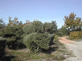 | There was a stretch of the D11 then off into the “garrigue” and the “bosquets” again - scrub and woods, I suppose. I passed through Bèdes hardly noticing it, and pressed on towards Jouques, where I hoped to be by lunchtime. |
|
 | The junction of the GR 9 with the GR 99A |
|
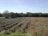 | A field of lavender |
|
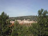 | I got to Jouques about 12.30, a historic Provençal village situated on a rocky ridge that boasts several medieval buildings. I had some difficulty finding the way down past the chateau and church to the village centre. Then over the bridge and up the other side of the valley, where I found a nicely situated roadside bench where I sat and had lunch. I was soon off again and getting slightly lost on my way through the new housing estate. |
|
 | Back on the GR I was soon off into the woods again, with much clearer paint-marks now. Just as well, as there was quite a maze of roads and tracks. |
|
 | Finally I emerged on the D11 once more, and read the topo-guide with a sinking feeling - 7 km on this road - the next two hours weren’t going to be very interesting. Well, it was the afternoon, perfect time of day for a long mindless tramp and it didn’t seem too long before I was climbing up the winding road towards the Col du Grand Sambuc. |
|
 | It was a great feeling to finally reach col. By this time my knees were hurting, despite the almost complete absence of steep descents. |
|
 | I came down the other side and arrived at the turn-off to the Carraire d’Arles, realising that I’d been making much better time and was again an hour ahead of schedule for catching the bus at Vauvenargues. So I relaxed my pace and strolled along this pleasant “chemin rural de France”, whatever that means. Then off down a side track, which soon narrowed to nice winding woodland path - a picturesque end to the walk. |
|
 | The ridge of Mont Sainte-Victoire in the fading light |
|
 | On the way down into Vauvenargues there is a good view of Picasso's chateau. Pablo Picasso bought this chateau in 1958 and when he died in 1973, according to his wishes, he was buried in the grounds. The chateau is not open to the public, so this is probably one of the best views of it you can get. |
|
 | The last section of the walk was a very steep descent down into Vauvenargues, and my knees were complaining vehemently. At last I staggered down through the little streets to arrive at the main street, and the bus-stop. I sat and ate my Mars Bar then, to kill the time I still had, wandered up and down the village. Amazingly Vauvenargues seemed to have quite a hopping night-life, on Saturdays at least, and the cafés were quite crowded. The bus back to Aix was not busy, but did have the statutory group of German tourists (see Mont Sainte-Victoire) and a group of six English people who seemed to be studying in Aix. I got back home by 7.30, with very painful knees, having successfully completed my longest walk so far in France. |
|

