| Click here or on any picture to switch to slideshow |
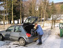 | Ruth and I had been hoping to do a walk together during the family's annual visit to Edinburgh in February, and the second Wednesday was the last day left when I was free. So Ruth took the day off work and picked me up from the Bryces' at 6.30am. The forecast for the day was pretty good, better in the west, but Ruth had been looking into avalanche risks and these were high in the west, minimal in the east. So we decided on Mayar and Driesh, which Ruth had actually been up several times, including one trip less than two weeks earlier. Well at least we had an experienced guide with us! It's worth mentioning that the avalanche risk in the west was real - just a week later two people were killed when they started a small avalanche on Buachaille Etive Mor. We made good time up the M90 and on through Blairgowrie to Glen Clova, where there were some welcome loos at the car park, open already when we arrived at about 10 to 9. In fact according to the Scottish Natural Heritage website, they are open 24 hours. This at least made the £2 parking charge seem more worth it! |
|
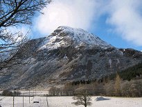 | We managed to get off walking by about 10 past 9. There had been a lot of snow all across Britain during January and the hills were all still covered. It was pretty cold, but with almost no wind it was perfect weather for winter walking. |
|
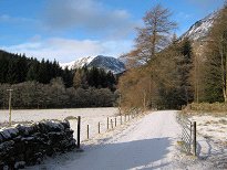 | The start of the walk is very civilized, along the forestry track which runs below Glendoll Lodge. This used to be Glendoll Youth Hostel, which closed around 2002 and is now privately owned. I remembered my only visit there on a cycling trip from St. Andrews in April 1981. In my diary at the time I described it as "quelle groovy place". What on earth was I on back then?? |
|
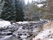 | On Ruth's recommendation we were planning to go up by Corrie Fee and come back down by the Kilbo Path. The track to Corrie Fee follows the White Water on its north bank up through Glendoll Forest for some way before crossing it and then heading uphill beside the Fee Burn, deteriorating to a path later on. |
|
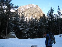 | It was nice easy walking, the only downside being that, although we could see it was a beautifully sunny day, we were now in the shadow of the hills we had come to climb. |
|
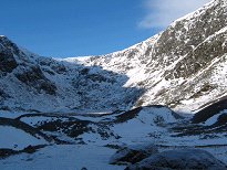 | At the edge of the forest we crossed a stile and found ourselves looking out across Corrie Fee, an impressive little amphitheatre with the Fee Burn meandering among the tumbled hummocks in its flat bottom. Apparently Corrie Fee is a site of "international ecological importance" and forms the main part of the Corrie Fee National Nature Reserve. Among other things it features some rare arctic-alpine plant species, which we failed to spot I have to confess. We stopped by a large rock near the stile for a drink and some liquorice allsorts which Ruth had very cleverly come equipped with. |
|
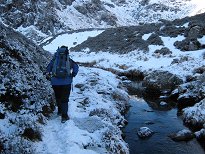 | The path leads across the left side of the corrie, which still kept us well out of any sunshine there was to be had. Were we taking note of the rare arctic-alpine flora of international importance that was to be seen all around us? Er, no... |
|
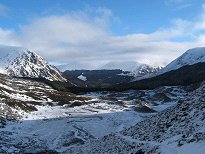 | As we climbed we got an impressive view looking back down into the corrie and over Glendoll Forest. As well as sporting lots of rare plants, Corrie Fee is also "one of the best examples of a glacial corrie in the British Isles". I'm sure a geologist would be excited about those hummocks all over the corrie floor, but unfortunately I'm not a geologist so to me, they're just hummocks. Nice hummocks, mind you. |
|
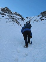 | The route we were following was pretty much the one described in Steve Kew's Cicerone Guide, except that Ruth led us off to the left at this point up quite a steep gully, whereas the Guide suggests staying on a path by the Fee Burn for longer. Anyway, no paths were visible, only boot-prints in the snow, and several people had clearly been up the gully before us, so it was a well-trodden route. Before the steep part we stopped and put on crampons. I had fortunately been able to borrow a pair from the Bryces, but this was my first time using them apart from a winter walk with a large party on Ben Lawers about 30 years before. I'm not sure if I got them on correctly since they seemed to slip sideways a bit during the day, but in general they did the job. |
|
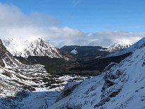 | It was quite a slog, especially in the snow, but the crampons were great for this part, and the steep section didn't last too long. And of course, the views were getting better and better as we climbed. |
|
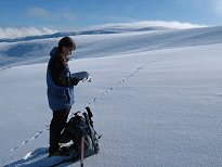 | And then we were at the top of the steep gully and out into the sunshine and the vast white expanse of the plateau. On my first visit to the White Mounth back in August 1996 it had crossed my mind to wonder why this vast upland was called the "White Mounth". OK, I think I get it now… At this stage the upper part of Mayar was still in a little cloud so it wasn't entirely clear which way we should head for the summit. We no longer had any boot-prints to guide us, only rabbit tracks. And who knows? Perhaps the rabbit wasn't actually bagging Munros. However Ruth soon had the map and compass out and set us off in the right direction. |
|
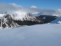 | The views were now superb. There was still quite a climb up to the top however, made more tiring by the fact that we couldn't actually see the summit yet so didn't really know how much further there was to go. |
|
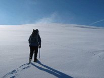 | The virgin snow was really wonderful to see - it almost seemed a shame to leave a trail of cramponned bootmarks across it. Mind you that rabbit didn't seem to mind messing up the unbroken whiteness. And all the while we could see that the wisps of cloud ahead of us were gradually clearing. Chance of a cloud-free Munro was definitely on the rise! |
|
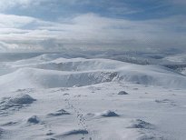 | And then the summit came into view and before long we were there. The wispy cloud was still coming and going so we were taking pictures whenever we could see the view. This is looking south, the swelling lump in the centre of the picture being Bawhelps (830m) as far as I can tell. In the distance to its left is most likely Badandun Hill (740m). |
|
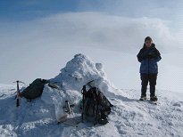 | Since no-one actually knew where we were, Ruth had been trying to send text messages to a couple of people to let them know. I think she didn't actually get a signal until we reached the summit of Mayar. That is in fact the summit cairn, not a half-hearted attempt at a snowman. The flask was another of Ruth's great ideas - chai tea, which I had never tasted before but which was nice and warming. Since there was still virtually no wind we had the luxury of being able to hang around for a while and eat some sandwiches. |
|
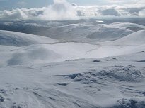 | As the wisps of cloud finally disappeared we could now see in the distance a body of water which I suggested might be Loch Callater. Which shows how hopelessly lost I was - from Mayar, Loch Callater is to the north west, whereas the thing that we were looking at was Backwater Reservoir, almost due south. The wide dip in the foreground is the upper part of Glen Prosen, the branch to the right being White Glen. Looks pretty white from here, right enough. |
|
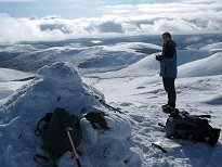 | And now the cloud really did clear completely and didn't trouble us any more for the rest of the day. |
|
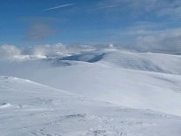 | We could now also see Driesh clear of cloud to the east, and looking quite far away. Time to get moving again. Oh, and look - that white rabbit is off ahead of us again! |
|
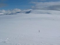 | Now I'm not saying anything against Mayar and Driesh - a couple of very fine hills indeed - but as far as fenceposts go, this is a pretty poor showing, you have to admit. We'd passed a couple of others, but compared with some other Munros, such as Carn na Caim or Carn Sgulain, this was nothing. Of course, there may have been lots more buried under the snow I suppose. |
|
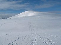 | By now we had picked up a line of boot-prints again, which we took to indicate the best route over to Driesh, although Ruth was of course also going by memory of her last visit just ten days before. |
|
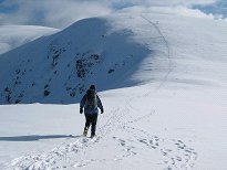 | It was certainly a day to be out on the hills but we had them virtually to ourselves. About halfway over to Driesh we met two people coming the other way - the only two people we saw on the hills all day, although we also saw some people at the bottom later on, and others in the car park, morning and evening. Some of the folk we saw in the car park were doing ice-climbing in Corrie Fee. No doubt paying as much attention to the internationally important flora as we were. |
|
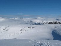 | This is the view looking northwest over the White Mounth. It's quite tricky to identify the peaks, if you can use a word like "peak" to describe anything on the White Mounth, but I'm guessing that the two slightly higher lumps visible in the distance are Cairn of Claise (1064m) and Carn an Tuirc (1019m). |
|
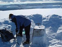
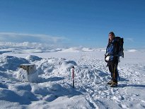 | The slope up to the summit of Driesh was fairly gentle, but it still seemed to require quite a lot of effort to get there. Finally we arrived at the summit to find the wind shelter and triangulation point mostly buried under the snow. Comparing photos of Driesh summit taken in summer, you can see that Ruth is standing on at least three feet of snow here. |
|
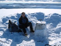 | The wind shelter was therefore somewhat reduced in its effectiveness today, so it was just as well there was almost no wind. It was time to sit down for a bit and enjoy a second lunch, not to mention the stunning views all around. |
|
 | The fact that there were fantastic views in all directions suddenly reminded me to take a 360º movie. The only problem was that I didn't have much idea at the time what I was looking at. The stretch of water to the south, as noted earlier, was not Loch Callater but Backwater Reservoir. The other landmarks identified may be approximately correct. |
|
 | We'd arrived at the top of Driesh at about quarter past 1, so we reckoned we were making good time. We probably hung around for nearly half an hour before setting off again to retrace our steps to the Shank of Drumfollow, where the Kilbo Path crosses the high ground on its way from Glen Prosen over to Glen Clova. The line of the path is visible here as a straight line angling down the slope from left to right. |
|
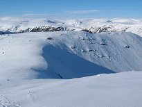 | The Shank of Drumfollow, Tom Buidhe and Lochnagar beyond |
|
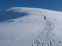 | As usual as soon as we started down hill I was ahead - I think I must just be more sensitive to gravity or something. Anyway, it gave me the chance to get an action shot of Ruth heading towards me rather than away from me for a change. |
|
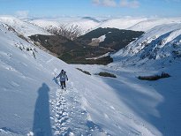 | The Kilbo Path is an ancient right of way, presumably a drove road, which links Glen Isla, Glen Prosen and Glen Clova. I imagine a herd of cattle would have to go in single file down this part of the path at least, which would string out a big herd along most of the hillside. We both managed to stay safely on the path all the way down although the hillside is fairly steep and the awkward angle was playing havoc with my crampons which kept slipping off. |
|
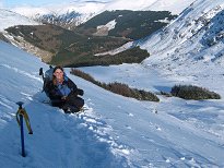 | We stopped a couple of times on the way down, while Ruth practised her ice axe arrest and took pictures looking uphill into the sun, and I fixed my crampons and took hopelessly lopsided pictures looking downhill into Glen Doll. |
|
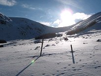 | And here's one of mine taken into the sun. This was nearly at the bottom of the long straight part of the path, just before we entered Glendoll Forest again. It was here that we met a couple with a dog who asked us if we thought they could get up without crampons. I was surprised they seemed to be setting out so late in the day until I realized it was only about half past 2 and they still had a good 4 hours of daylight left. Anyway, they carried on up the path to see what it was like. |
|
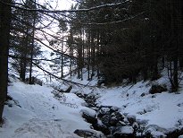 | The path now led into the trees which gave a change of scenery, and a bit less snow underfoot, although we kept the crampons on for the time being. |
|
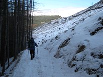 | After a bit though the snow lessened and we stopped to take off our crampons. This was a relief for me as I was still having difficulty keeping them properly in place. For some reason I took off my belt bag for this operation then forgot to pick it up again when we set off. Luckily I remembered it not too far down the hill and hurried back to get it. |
|
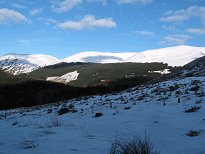 | The sun was still out but we were once again in the shadow of the hills by this time. |
|
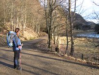 | Then we were down on a track again, although not the track we'd come up in the morning yet. We joined this when we were almost back by Glendoll Lodge - quelle groovy place! Especially now that we were back in sunshine again. The track that had been layered with frost in the morning was now just wet and muddy. When we got back to the car at about twenty past 3 Ruth got out her flask of hot water to make a nice cup of tea - wonderful! Then we were off down the road and once again made good time until we got close to Edinburgh where we hit rush hour traffic. But even then we were back at Mum's before 6.30 which was when we were supposed to be there for dinner. This was the fourth time Ruth and I had done a climb in February and we'd had great weather on three of the four occasions - I was rapidly losing my prejudice against winter walking on the grounds that the weather is generally worse than in summer! |
|

